Posts

Showing posts with the label hobby

Field Tracking and Running for My Life

Image
THE WELCOMING FIELD I had taken note of some impressive farmland in Langrangeville and hoped to grab a few shots today. Apart from the proximity of youngliings stamping the gas of their obnoxiously loud Mustangs, it began as a pleasant experience. I found a safe gravel inset to park my car and up the road I walked, looking for vantage points and keeping an eye skyward, as to escape rain, should it rear its ugly head. THE TRAP After capturing a few places to my satisfaction, I came upon a dirt road leading into the field. As is my practice, I checked for "no trespassing" signs, of which none declared themselves. Deeming the road safe for exploration, I began to press in. First, a deer took me by surprise, leaping from the shrubbery with great speed and disappeared into some trees. A short distance further, an unsettling buzzing noise tickled my ears. To  my great dismay, a cloud of large, black insects had gathered behind me and looked to be in pursuit. I hazar...

A Walk Around and Through the Woods

Image
I realize that it's been several weeks since my last post. Truth be told, the only reason I get to post today is because I'm sitting in my favorite pizza shop, enjoying my "Dad's Night Out". I haven't been out much of the last several weekends, on account of my new baby boy arriving. That makes today very special, because I took some time this evening to find some new places to photograph. I made plans right after work to take in the "Ridgefield Landscape" a bit. Before art, I really wanted to run and stretch out, after a full day of work. My boss (who is a fellow runner) recommended a rail trail within a mile of where we work. Many of the town roads (and back roads) are dangerously narrow, and basically put you in the optimal position to play chicken with very aggressive townies in their BMWs. I took my boss's advice and pressed on to the rail trail. I covered close to four miles and felt great! After cooling off just a bit, I made stops...

Looking for Land

Image
After taking historical pursuits for a bit, I found myself missing landscapes, and really wanted to find a location with some space. There's a good spot along Route 376 that I'd been telling myself would be a good place to shoot. Today was the day! I'd shot in a marsh before, but never gone this deep into one. I was glad to have my boots and knock-around jeans. The water never accumulated more than three inches, but made some shots a little "juicier" than others. It took me a a bit to find the kind of angles I was looking for, as there some houses off the in the distance on one side, but I did manage to pull a full frames that made me proud to take home. One of the stops was Emmadine Pond, which I'd never visited before and a quick search didn't reveal much regarding the name (or reason there for). Regardless, it was a nice place to visit and walk. I'd reccommend it for anyone looking for a quiet morning or afternoon retreat. For th...

Almost a Hospital

Image
I've continued to research the Livingston family, as they have a long, intricate history within the US. Unfortunately, outside of Locust Grove and the Poughkeepsie Rural Cemetery, it seems that a good bit of driving would be necessary to visit any remaining locations pertaining to the "Lords of the Livingston Manor", as they were so deemed when settling here in America. Some day, I'll venture further out (The next closest location I could visit is Clermont in Germantown, NY), but for now, I'm doing my best to keep trips within twenty minutes, to ensure my adventures don't get in the way of seeing my family. Almost a Hospital I changed venues and decided upon Vassar College this morning. I researched the school history to get my bearings and began to learn of Matthew Vassar, a self-taught gentleman who made a fortune as a brewer. I learned that as he advanced in years, he wished to leave a legacy behind. He never married, and had no heirs to leave his fortun...

Oh Smith, Where Have You Gone?

Image
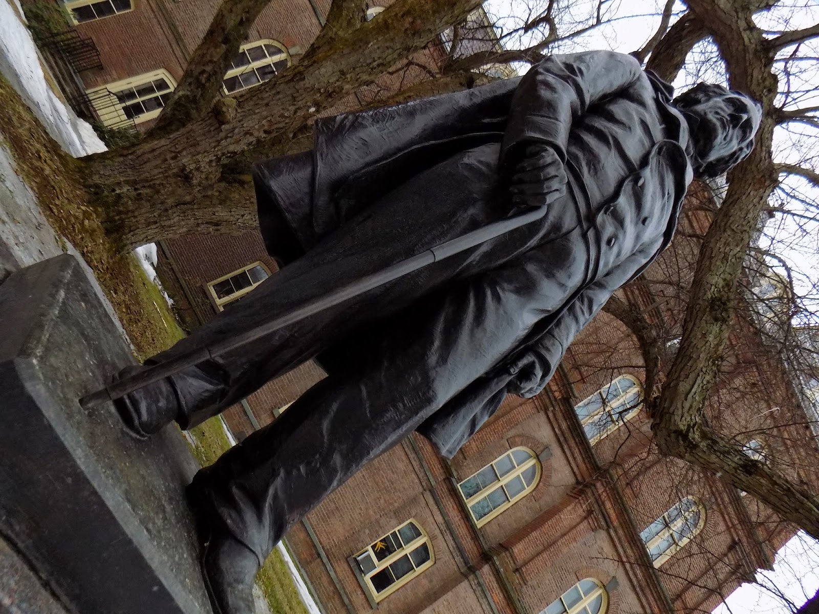
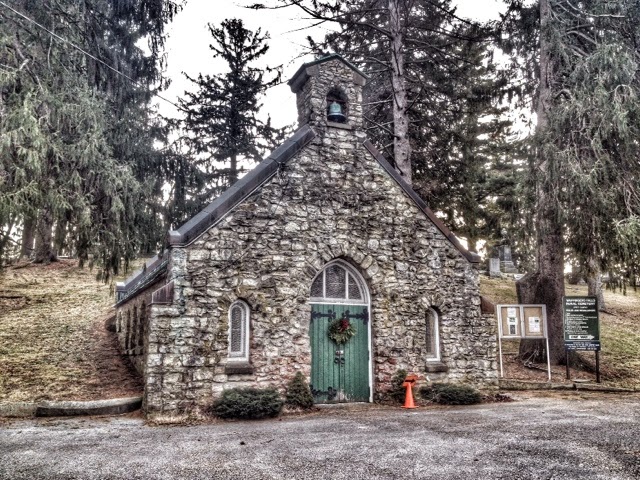
I returned to the Poughkeepsie Rural Cemetery today, focused on searching for former Chief Justice Smith Thompson's residence. To learn the known background, please refer to my previous post ( Life Around the Livingstons ). Same as last weekend, I found a parking space around the mausoleum and worked my way across the grounds, searching for clues (I even pulled up the Google satellite view on my iPhone to locate streams). Oddly, nothing obvious appeared. Undeterred, I pressed on through snow and ice until I reached a corner, right up against the railway system and the Hudson River. I continued forward, surmising that I should stumble on it, as the cemetery is largely elevated, indicating that a stream would have to cross under the train tracks into the Hudson. Before too long, the sound of running water became clear, and I found a very likely candidate for the Thompson residence. Interestingly, it appears that it is still an occupied home, on cemetery grounds (Smoke was puffing for...

Life Around the Livingstons

Image
Next to the Farm My previous adventure covered the history of Locust Grove ( Once a Farm ), and I was curious to explore just how far back the story stemmed. Even before the sale of the Livingston farm into plots, another partial owner comes into play by the name of Smith Thompson (1768-1843), who had purchased 133 acres from the Mitchell family, who later married into the Livingstons (Hence, "Livingston Farm" as it is remembered). Smith was a Associate Justice, Chief Justice (Under President Monroe), and husband of Sarah Livingston (Of the same Livingston Farm). His land eventually became part of the Poughkeepsie Rural Cemetery, after his passing (Ref -  http://www.henrylivingston.com/bios/smiththompson.htm ). Based on this, my new quest has begun! Smith Thompson I visited the Poughkeepsie Rural Cemetery today, despite the rain, in the hopes of beginning to search for any remains of his estate. I know that he was buried on the same land, which would indicate tha...

Once a Farm

Image
The Missing Blog Post To recap for the last two weeks, my previous adventure covered a different direction on the Dutchess Rail Trail, at the Lake Walton Road access point. I meant to dig into what the trail was once upon a time, to confirm if it really was a "rail" road or if the name is simply a "pet" name of sorts. There are hints that something predated the trail as we know it, being that there are low hanging, retired power or com lines a long the stretch of it. I hoped to find out more and make a post much sooner than this week, and... well, life took me out of reach of making that post last Saturday. As a cop-out, please accept the following mysterious image as evidence of my desire for hunting the histories of the trail. My apologies for letting you down last week! In case you missed the photos from this adventure, please see the related Flickr album -  https://www.flickr.com/photos/129003675@N04/sets/72157648621526894/ Once a Farm Moving forward...

Coup D'état of Warm Weather

Image
I missed my usual adventuring this past Saturday, as I had to be at work all day (8am to 9pm) on a time-sensitive, critical piece of our 18 month project. Sunday I felt out of my head, like none of my faculties could handle anything more interesting than feeding myself (Plus, my eyes kept forcing themselves closed, prompting me to sleep here and there). So today, my job is closed down for Presidents' Day and I took the opportunity to take just a few photos and keep active. My apologies for anyone who came expecting a post on Saturday! General safety counsel suggested minimizing exposure to the elements to fifteen minutes at a clip today, given the extreme cold temperatures with wind chill (-10 F for our area). Understanding this limitation and further noting that most things I normally like to explore are buried under three feet of total snow accumulation, I opted for another stroll around home. There was a lot of interesting contrast of stark objects with a clear, blu...

Exploring I Went - I Found Something Else

Image
I went adventuring this morning with the intention of exploring some local attractions. One, was the Brinckerhoff house, belonging to Colonel John Brinckerhoff (1703 - 1785, Soldier in the Revolutionary War - Ref -  http://www.goodreads.com/author_blog_posts/2231878-the-patricians-colonel-john-brinckerhoff-1703---1785---revolutionary ). The link includes a modern picture of the home, which is still in good order and actually a residence (Hence, why I have no picture). I was fascinated to learn that George Washington was a frequent guest and close friend of John Brinckerhoff. Knowing that these men well trod upon the same ground which I traversed really connects me to them in a meaningful way. There's more history to uncover connected to this, which I believe stretches over into my present investigations. I'll be doing some other digging in the future. Not to be deterred by the inability to photograph today's initial pursuit, I took to a backup location off Lake Walton Roa...

Working Around the House

Image
The learning continues! For some things, I've tried shooting the same image under different settings to get a sense of how much exposure is utilized (which affects how fast the picture is snapped). Also, the Auto white-balance seems a just a hair off, so I've taken to manually setting it as I go. The results do come out better that way. I really wanted to try something new today and continue to challenge myself. While I enjoy photographing inanimate objects that don't move even if I ask them to, I wanted to try capturing some people, so I enlisted the help of my kids. It's a little tricky photographing children who appear to be jumping through space and time against the laws of physics, but I manged to sneak in a few snaps and learned some new things along the way. For anyone who is missing the historical journey, please don't worry! Provided the weather isn't trying to freeze my camera, I'll be "back in the field" next weekend. Today just ...

A Return to My Beginnings

Image
Today, I decided to return to the Hopewell Rec Center to begin the journey anew with a brand new camera (Nikon CoolPix L330)! I'll confess that it's not everything I'm after, but it's worlds better than shooting with my iPhone. It doesn't have quite the manual control I need, which I knew this going into the purchase, but it was the best upgrade I could afford with a gift card and savings. This is not to say that I'm unhappy with the camera, it's just something new to aspire to with future savings! I've enjoyed the quality of Nikon products as of late (I purchased a Nikon CoolPix S9500 for general family use) and have become a full convert from Canon (For clarity, I'm not being paid anything by Nikon to mention them). All that aside, it was a bright and beautiful 15 deg F morning. Being that I haven't had a good daytime opportunity to test shooting with my new camera, I wanted to return to familiar ground and begin to learn how to operate this ...

The Story of Mesier Park

Image
I was all stoked to visit Mesier Park this morning, given my discoveries last night, as added to an earlier post ( Hunting for the Wappinger Mill ). I had learned some very intriguing history about the origin of Mesier Park, including that the land (Actually 750 acres) was originally owned in 1741 by two Dutchmen (Nicholas and Adolphus Brewer - Ref -  http://www.wappingershistoricalsociety.org/mesier.shtml ). Adolphus died after being struck by lighting, and was the first to be buried in the Zion Episcopal Church graveyard. The church still stands and I'm looking into visiting Adolphus Brewer's burial site as a future adventure.  This is where the story gets fascinating. I'll quote from the Wappingers Historical Society site: " In 1776, a well-to-do loyalist tea merchant from New York City, Peter Mesier, arrived in Fishkill. He bought the 750 acres of land and the homestead from Nicholas Brewer and opened a small store in the homestead. Mesier angered his cust...

Hunting for the Wappinger Mill - UPDATED

Image
Taking a small departure from my usual routine, I went on this week's photography adventure on a Friday, being that I had the day off. I've been searching out historic sites within the Wappinger area and landed today in the Village of Wappinger, trying to locate the cotton-textile mill, originally constructed in 1819. After a little research, it seems that the original construction was destroyed by fire and quickly rebuilt in 1856 (Ref -  http://www.livingplaces.com/NY/Dutchess_County/Wappingers_Falls_Village/Wappingers_Falls_Historic_District.html ). I parked in a comfy two-hour parking slot and went adventuring, starting at Wappingers Creek Bridge (Originally constructed in 1852, but re-constructed and widened in 1884 - Ref -  http://bridgehunter.com/ny/dutchess/1006380/ ), which supplied a fantastic view of the gorge below, but didn't give me any clear hints as the exact whereabouts of the mill. I walked down Market Street for a bit, which proved fruitless, as ever...

Walking About with the Quiet

Image
I decided upon the Wappingers Falls Rural Cemetery ( https://www.facebook.com/WappingersFallsCemetery ) for today's photography adventure. I was scouting on Google maps, looking for a new location and happened first upon the Middlebush Cemetery ( Google Map ), but I was looking for larger ground to cover. In a list of historic attractions, provided by the Office of the Town Historian (Wappingers -  http://www.townofwappinger.us/pdf/Historic%20Sites.pdf ), next to pop on the list for me was the Wappingers Falls Rural Cemetery. It actually took some work to locate, as it isn't registered on Google Maps and doesn't appear to have an official web presence, other than a Facebook page I stumbled onto, which gave me enough clues to locate it by studying Google satellite telemetry. I took a slow drive through the Village of Wappingers and successfully found the entrance. My first challenge was navigating the space, as I'd never been there before and the road is mono-dire...

Walking the Railroad Tracks

Image
Yesterday, I took to an abandoned circuit of railroad tracks that pass through Wappingers \ Hopewell Junction. I only ventured about a mile into the tracks before becoming immersed. At parts, I found old gas cans, un-potted plants, and parts of discarded railroad ties. While hiking around and studying the layout of objects, I couldn't help but begin to see stories in my head of when the tracks were built. In doing some quick research, it appears that these tracks originally belonged to the Erie Lackawanna Railroad,  constructed between 1832 to1851 (Almost a 20 year project! - Ref -   http://www.american-rails.com/erie-lackawanna.html ), and was designed to run from Piermont, New York to Dunkirk, New York. According to the available notes, over a hundred years into operation, it seems that most of the routes belonging to Erie Lackawanna Railroad were abandoned in the 1970's (Ref -  http://www.hurricanescience.org/history/storms/1970s/agnes/ ). Hurricane Agnes (1972) w...